Live veiling - Lot 500
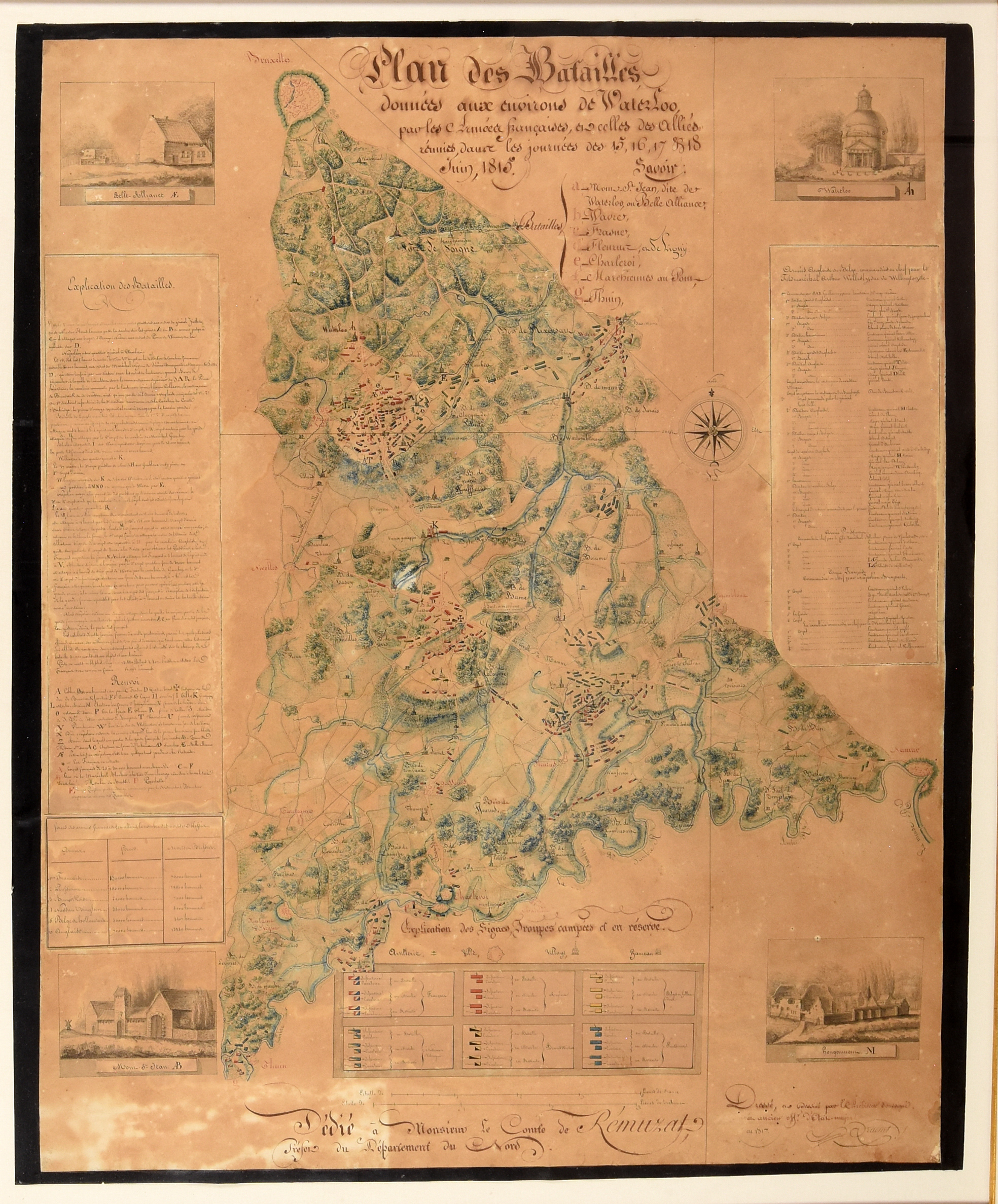
[Manuscript map - Belgium - Waterloo]
"Plan des batailles données aux environs de Waterloo, par les Armées françaises, et celles des Alliés réunies dans les journées des 15, 16, 17 & 18 juin, 1815.
1817"
Hamerprijs: €
1.600
€ 800 / 1.000
Live bieden (Drouot*) Live bieden (Invaluable*)Biedingen zijn afgesloten.
Beschrijving lot
Drawing, black and brown ink, watercolour, paper, 78,5 x 63 cm (browned).
Under passe-partout and gilt frame.
Close copy after the famous map of the Battle of Waterloo by Pierre-Jacques Goetghebuer (Ghent, 1788-1866), who travelled swiftly to Waterloo to observe the battlefield, resulting in an elaborate and memorial chart. This copy depicts the battlefield, incl. the various positions of the French and Allied troups, its large surroundings (o.a. Brussels, Namur and Thuin), 4 views ("La Belle Alliance", "Waterloo", "Mont St. Jean" and "Hougoumont") and explanatory cartouches. It is signed Braemt, possibly Joseph-Pierre Braemt (Ghent 1796-1864 Brussels), Belgian medalist and coin designer, who studied at the Royal Academy of Fine Arts (KASK), roughly during the same time that Goetghebuer was connected to the Academy as well. Curiously dedicated to Auguste Laurent de Rémusat (1762-1823), "Préfet du Nord" between 1817 and 1822, while Goetghebuer's map was dedicated to William I of the Netherlands.
Ref. Misschaert, I. - "The Waterloo map of Pierre-Jacques Goetghebuer" in Print Quarterly 39/3 (September 2022), pp. 311-315.
Meer foto's