Live veiling - Lot 958
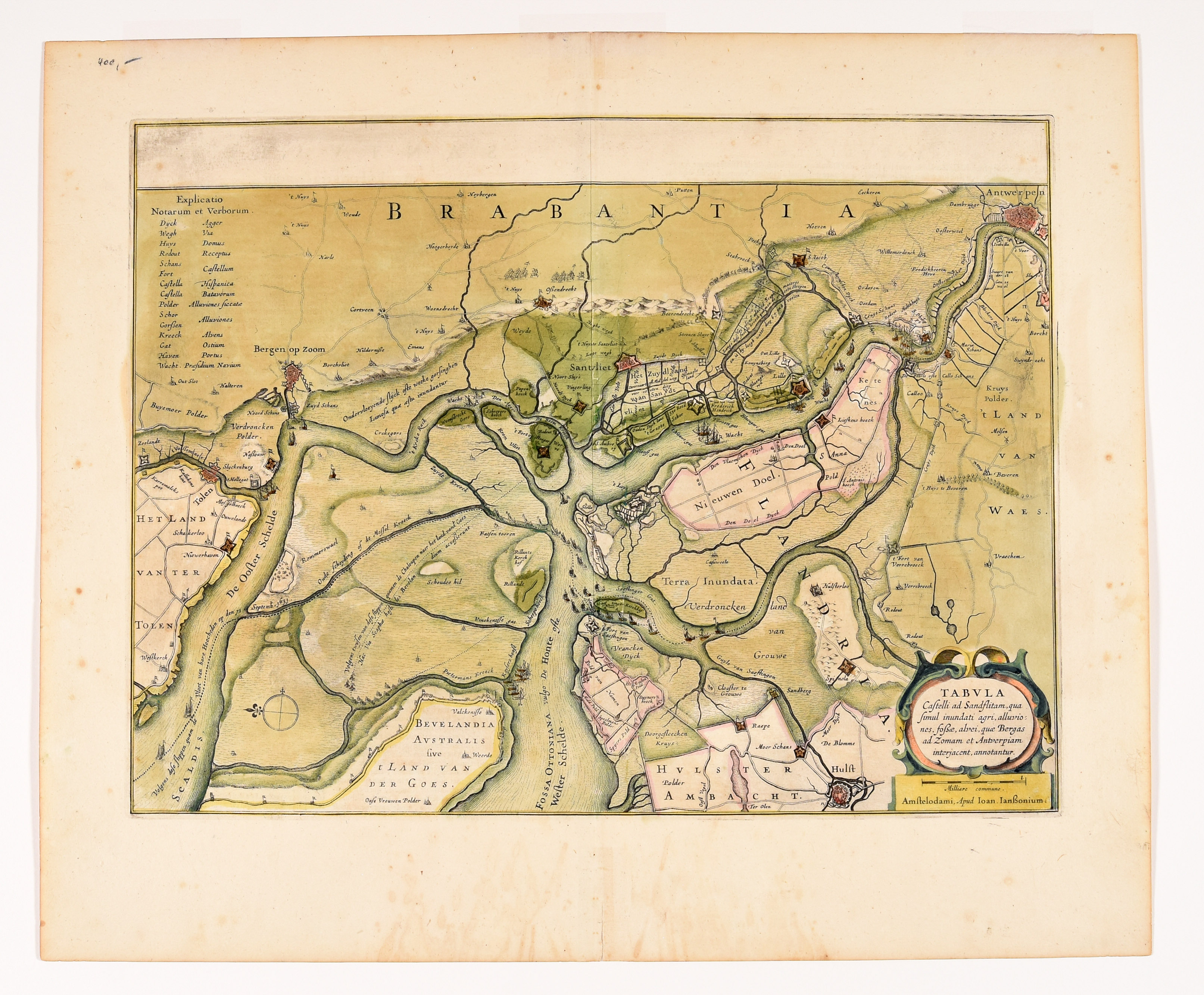
[Zandvliet]
Tabula Castelli ad Sandflitam, qua simul inundati agri, alluviones, fossae, alvei, quae Bergas ad Zomam et Antverpiam interjacent, annotantur.
Amsterdam, J. Janssonius
€ 120 / 150
Live bieden (Drouot*) Live bieden (Invaluable*)Biedingen zijn afgesloten.
Beschrijving lot
Engr., 36,8 x 48,8 cm, hand-coloured (sl. toned, upper marg. sl. soiled).
Hinged at upper edge. Under passe-partout.
Detailed map of the river Scheldt depicting the environments of Zandvliet at the time of the Battle of the Slaak (12 and 13 September 1631) between the Dutch States army and the Spanish troops during the Eighty Year’s War. Published in a French Hondius-Janssonius atlas between 1639-1649 (leaf 3y, no pagination).
Ref. Van der Krogt I [3120:1.2]. - Guns, P. - De Antwerpse noorderpolders in de 16de-17de eeuw. (figure 9).
Meer foto's