Ventes live - Lot 537
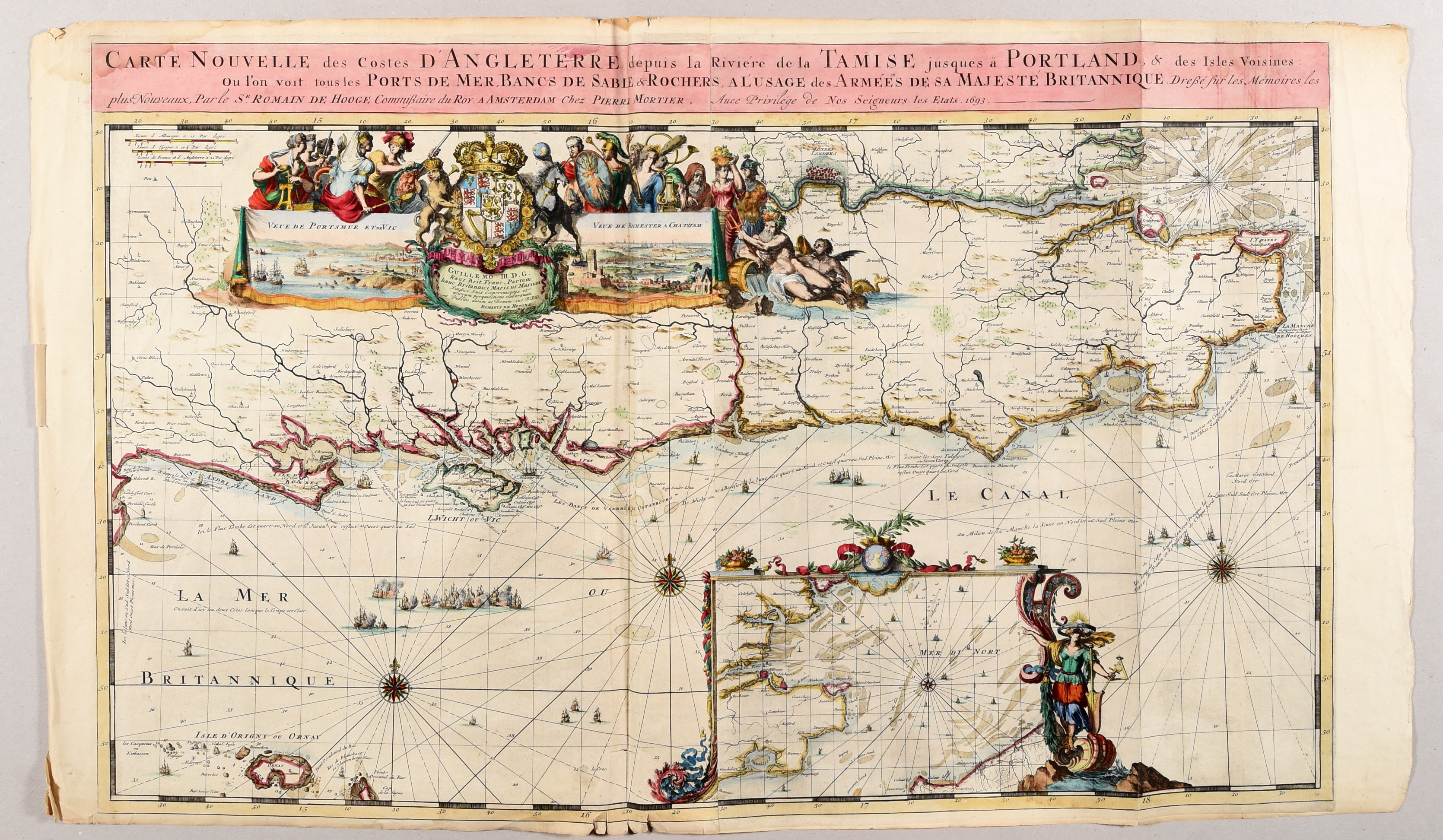
[Nautical chart - English channel]
Carte nouvelle des costes d'Angleterre depuis la rivière de la Tamise jusques à Portland [...].
Amsterdam, P. Mortier, 1693
Prix de marteau: €
950
€ 300 / 400
Enchérir en direct (Drouot*) Enchérir en direct (Invaluable*)Les enchères sont closes
Description du lot
Engr., 58 x 95 cm, hand-coloured (traces of folds, sm. tears in lower edge, outer edges sl. toned).
Large nautical chart of England, showing the mouth of the Thames and the city of London. With a beautiful, allegorical cartouche, 2 inset views (Portsmouth and the Isle of Wight, Rochester and Chatham) and an inset map of the Strait of Dover within an ornamental frame. One of the 9 charts from the "Atlas maritime [...]" by Mortier, the continuation of the "Neptune François".
Ref. Koeman M.Mor 5 (6).
Plus de photos