Ventes live - Lot 564
[Atlas - Low Countries]
Atlas assembled to order containing 60 maps, including "Atlas des Pays Bas" by Covens and Mortier.
€ 10.000 / 12.000
Enchérir en direct (Drouot*) Enchérir en direct (Invaluable*)Les enchères sont closes
Description du lot
17th-18th c
Folio: engr. title and 60 double-page maps (7 fold.), borders and most cartouches hand-coloured (paper strip with ms. title pasted over printed title, damp stains in some upper margins, occ. spots, few maps with light soiling on verso).
Contemp. overl. vellum, gilt-ruled boards, flat spine (sl. used).
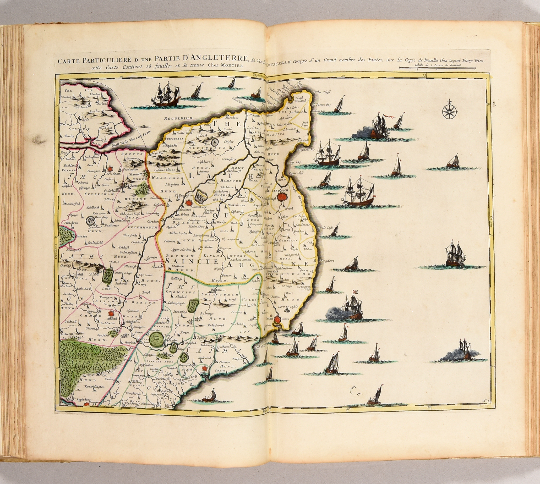
Composite atlas containing: a fully hand-coloured allegorical title-page from the Gerard Valk's "Nova Totius Geographica Telluris Projectio", 23 maps (of 24, missing "Carte des environs de Luxembourg") from the 1745 "Atlas des Pays Bas" by Covens and Mortier after E.H. Fricx. Other maps by Nicolaes Visscher (8), Frederik de Wit (7), Carolus Allard (6), Nicolas Sanson (4), Janssonius, Pitt & Swart (3), Guillaume Delisle (1), Vaultier (1) and 7 anonymous. Depicting France (1), Ireland (1), Scotland (1), British Isles (2) and 55 figuring the Low Countries in its various political appearances, published by Allard, de Wit, Jaillot, Husson, Mortier and Visscher. With ms. table. Detailed list on request.
Ref. Koeman C&M 17.
Plus de photos