Ventes live - Lot 572
[Atlas - World]
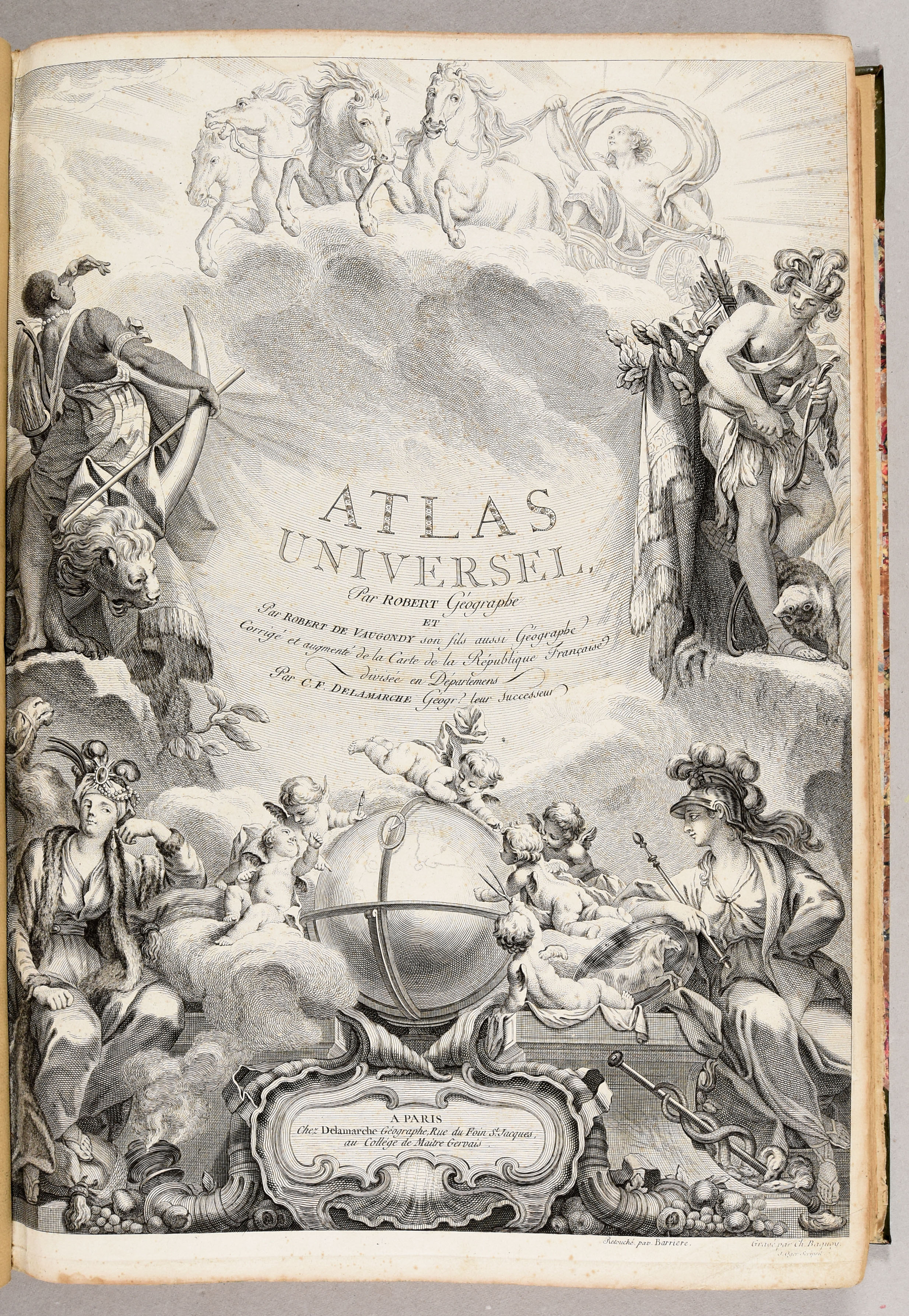
Atlas universel [...]. Corrigé et augmenté de la carte de la République française divisée en départements par C.F. Delamarche [...].
ROBERT de VAUGONDY, [Gilles & Didier]
€ 8.000 / 10.000
Enchérir en direct (Drouot*) Enchérir en direct (Invaluable*)Les enchères sont closes
Description du lot
Paris, Delamarche, [after 1788]
Folio: [4 incl. engr. title]-36 pp.; 117 maps, all border-coloured (occ. spotting, mostly marg., few sm. tears in folds, renewed endpapers, few margins starting to fray).
Mod. half leather, marbled paper boards, flat spine with orig. spine preserved (very lightly rubbed).
Complete later ed. of Vaugondy's Atlas, the first ever sold in France by subscription. With a title engraved by Ch. Baquoy, retouched by Barriere, and 117 maps of which the cartouches attracted unanimous praise from critics. The Atlas "commode, complet, uniforme et suivi" came to be the public's choice for more than a century. It was indeed not designed for the scrutiny of geographers, but for the public for "whom the maps furnish a means by which one might be transported to the scene and find oneself on the threshold of judging events and even of reflecting upon the future." Nonetheless, the de Vaugondys searched for geographical information with great thoroughness and used its sources according to a strict method. Edition printed by Delamarche, after the death of the previous editor Boudet, with 9 more maps than the first ed.
Ref. Phillips I:678. - Bel et utile 227.
Plus de photos


